Four Days Boat Camping on Lake of the Woods
Lake of the Woods is so large and broken into islands that even familiar territory can quickly feel remote. I set out alone from our family cabin near Morson with my dad’s fishing boat, four days of camping gear, and only a loose plan: work my way north to Kenora, then return through Whitefish Bay and Turtle Portage.
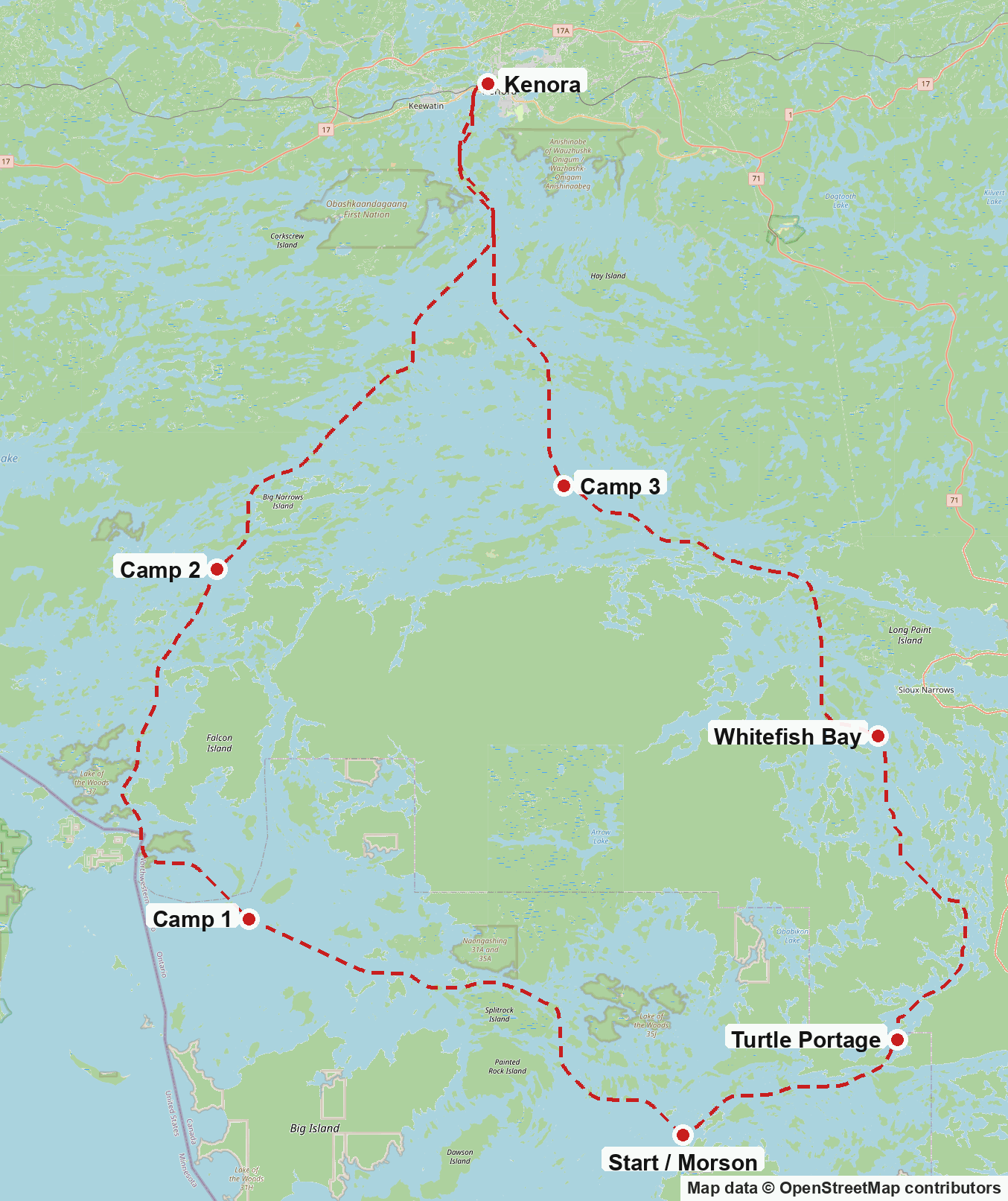
Day One
I set off around noon. I stopped near my favorite walleye fishing spot near New Moon Lodge. I caught two walleye for dinner, then realized I had forgotten the cooler with all my sodas, bacon, eggs, and sliced meat.
Thirty minutes back to the cabin, and I was setting off again around 2 PM. I knew I wanted to get at least as far west as Firebag Island, and I tentatively targeted Red Fox Island. I scouted Red Fox Island, the one to the west of it, and the two to the west of that.
First Night on the Rocks
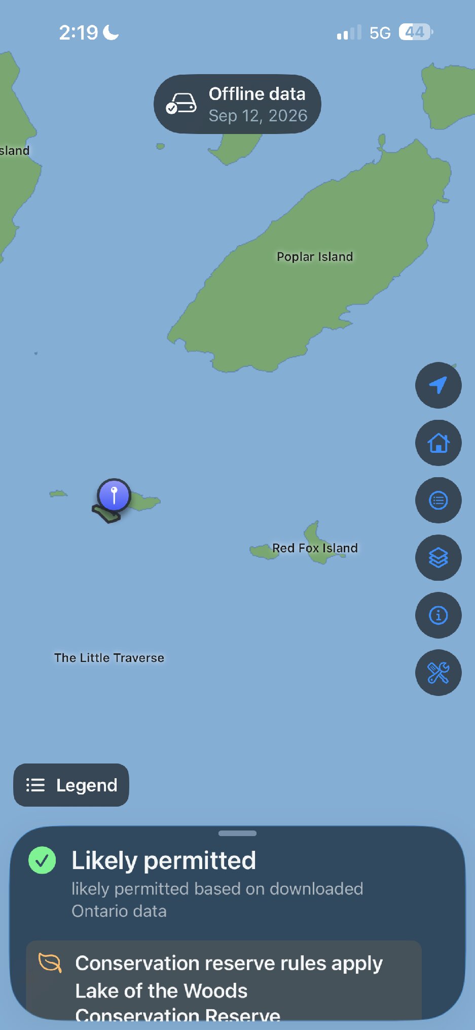
I camped on a 1.2-hectare island that was unnamed on the boat’s chartplotter. On the lake chart and my offline island map, it was combined with the island just to the east, but on the water it was a separate little island. A gravel reef connected the two and would probably be above water when the water was extremely low.
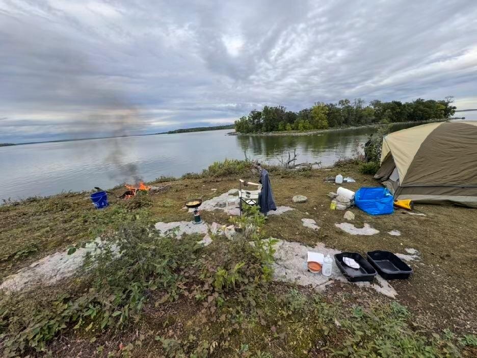
I set up on top of a rock overlooking the expanse to the north and east. I saw only one boat, which showed up about five minutes after I decided to camp there. I pitched the tent and started a campfire. I used my homemade dryer-lint, egg-carton, and candle-wax fire starters. They worked great.

I was getting a headache because I hadn’t eaten lunch or drunk enough fluids. I took some ibuprofen and took it easy while getting things set up around camp.
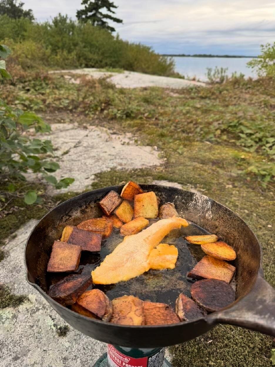
I got some potatoes going in the cast-iron pan. I opened the can of corn and set it next to the campfire. I used Shore Lunch breading on the fish and fried them in the same oil as the potatoes. It was an amazing dinner.
As I was finishing dinner, the wind started to pick up out of the north, and it looked like rain. Unfortunately, I had parked the boat on the north side of the island and didn’t want it banging against the rocks. I moved it around to the south side, into a little semi-protected bay. I spent a fair bit of time trying to get the anchorage just right, but I was never really happy with it.
The rain started around 8 PM and went on and off all night. I could hear the boat bumping against the gravel beach, and it really started to bug me. I knew there was a type of anchoring that lets you pull the boat away from shore and leave it floating freely while still being able to retrieve it. I had enough cell service to ask ChatGPT.
It turned out to be called a clothesline mooring. I should’ve waited until morning to test it, but I was awake at 2 AM and couldn’t get it out of my head. I managed to set up the clothesline mooring, but in the process I dropped the super-bright LED flashlight into the water and initially resigned myself to losing it.
The flashlight never turned off, so even though it was pitch-black outside, I could see the light in the water. I used the musky net to reach roughly six feet down to the bottom and retrieved it on the first try. What a win.
With the clothesline finally working, I ran the rope from the boat to shore and around a large rock. I used some of the yellow cord from camp as a backup line, just in case the clothesline came free from the rock.
How a clothesline mooring works
A clothesline mooring uses two anchor points, one ashore and one in deeper water, connected by a continuous loop of rope. The boat is secured to the loop. Pulling one side moves the boat away from shore; pulling the other brings it back. That allows the boat to float in deeper water instead of rubbing against the beach or rocks, while still letting someone retrieve it without swimming out.
A standard setup uses rings or pulleys at the two anchor points. Mine was a decidedly improvised version using the small anchor, the rope and hardware I had with me, a large rock on shore, and a length of yellow cord as a backup. It worked, although trying it for the first time at two in the morning was not my finest planning decision.
The offshore anchor still needs the correct holding power and scope for the boat, bottom, wind, and waves. The clothesline arrangement changes how the boat is moved to and from shore; it does not make an inadequate anchor secure.
Day Two
I woke up to the sun already up and felt pretty good after sleeping through so many ups and downs during the night. I started the day with bacon and eggs, nice and crispy the way I like them.

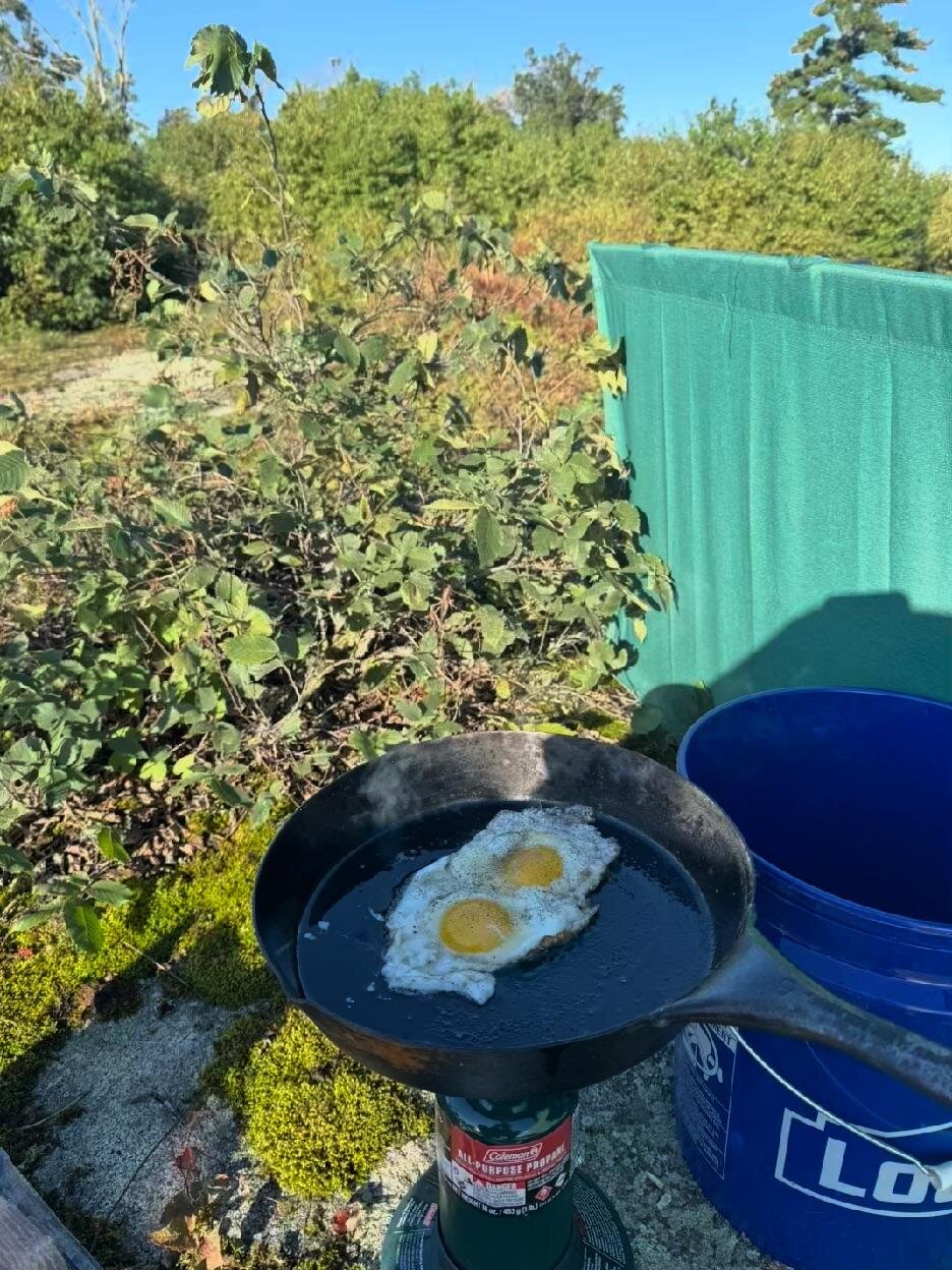
The wind was still out of the north, so I had to use my cot as an improvised windscreen. It worked pretty well. I also made some toast, initially just over the propane burner and then in the pan once the eggs were done.
It took me longer than expected to pack everything, mainly because I had to carry it downhill and stage it on the gravel peninsula before pulling in the boat from its new clothesline mooring. I finally got everything loaded and successfully got the boat away from shore.
However, I couldn’t find my sunglasses. The last place I had seen them was on top of my little rock hill, but I thought for sure I had grabbed them. I looked around the boat a bit more, then decided to go back. I have a bad habit of losing sunglasses on islands in Lake of the Woods, and I was determined not to do it again.
I landed the boat again and wrapped the bow rope around a big rock. I didn’t bother with the clothesline mooring. I climbed back up my little rock hill to my former campsite and looked everywhere, but I couldn’t find the sunglasses. Chalk that up to another pair donated to Lake of the Woods.
After leaving my island, I planned to head to Kenora. I thought I had better catch my dinner, so I fished around my little island for a bit. I caught a couple of bass, but that was it, so I kept trekking.
Massacre Island
My first point of interest was Massacre Island.
The island is traditionally identified as the place where, on June 6, 1736, a party of 21 Frenchmen traveling east from Fort Saint-Charles was killed by Dakota warriors and their allies. The dead included Jean-Baptiste de La Vérendrye, son of explorer and fur trader Pierre Gaultier de La Vérendrye, and the Jesuit missionary Jean-Pierre Aulneau. Historians generally understand the attack as retaliation for the French breaking an earlier alliance with the Dakota, although no one can say with certainty that the island now bearing the name is the actual site.
I didn’t know if the cross was still there, but I figured I’d take a look. I circled around from the south side first, and it wasn’t long before I spotted it.
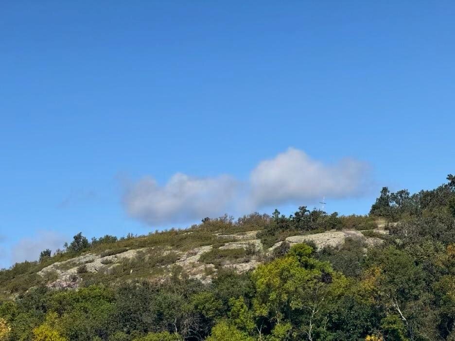
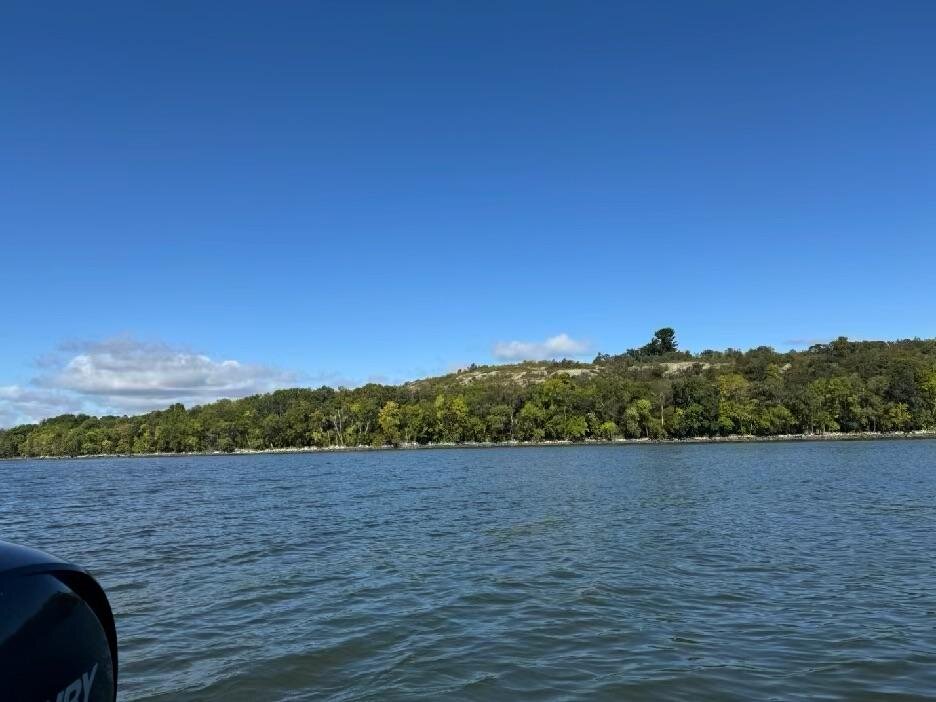
The island itself was visually unremarkable, but I was glad I had made the stop. The winds were firm out of the northwest, so I skirted around some little islands, taking my time to enjoy the ride. I headed in the general direction of Kenora and figured I’d let the day take me where it would.
Along the way, I came across four little islands at the southeast corner of Birch Island. There was deep water all around them, with shallow saddles in between. The area seemed sure to hold some walleyes.
It did. I caught a nice 17½-inch walleye that I couldn’t keep, along with a couple of other walleyes that I did keep. There were a lot of fish in the area, including some small bass. I figured I had better not linger too long, so I moved north and west again.
A Beach Near Toadstool Island
I was following the path north and just couldn’t pass up all this great water south and a little west of Big Narrows. In fact, I decided to make one of the islands my home. I thought it was Toadstool Island, but technically it was a little northwest and disconnected.
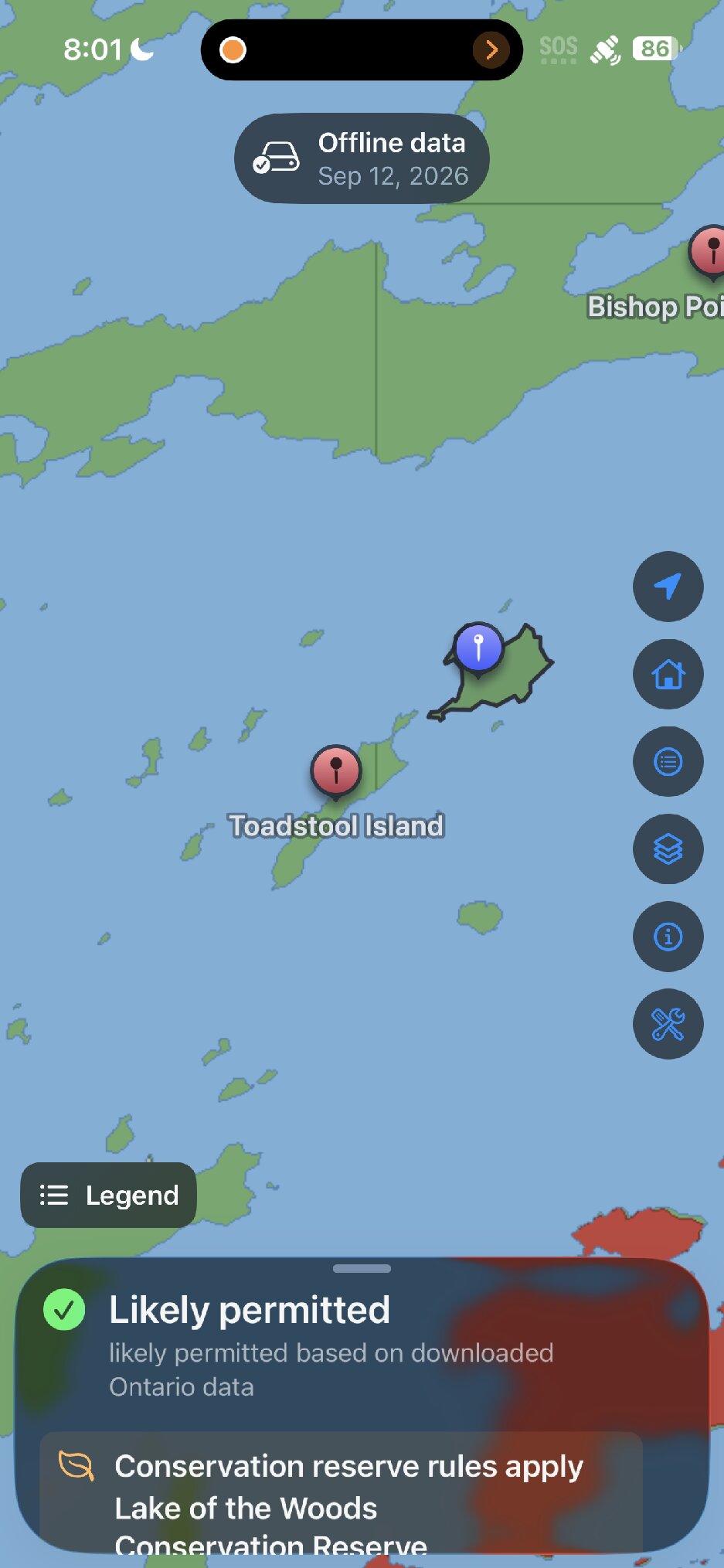
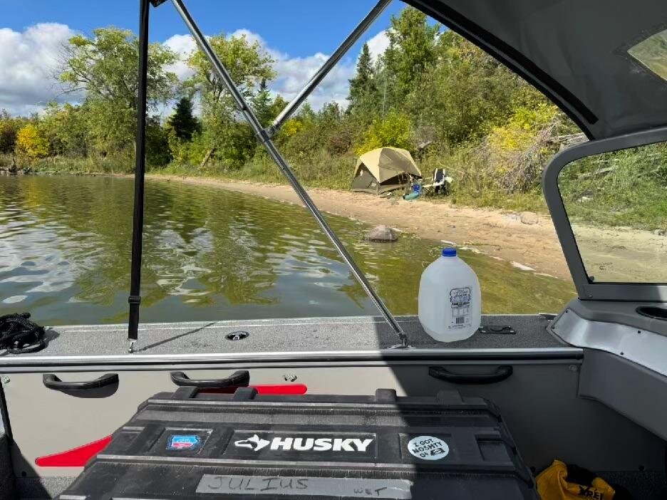
I set up a swell little camp on the beach and relished the soft sand. I didn’t really need a clothesline mooring, although I tried it at first. The anchor didn’t grab the sand very well, so I gave up and tied the boat to a tree. As long as the wind and waves didn’t come up that night, I thought it would be fine.
I trolled around for muskies at the end of the afternoon, just in case one was hiding nearby, but had no luck. I cleaned my walleye on the boat and headed back to camp.
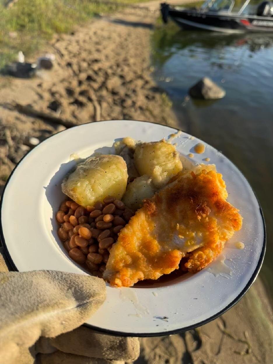
For dinner, I made Shore Lunch-breaded walleye, boiled potatoes with butter, salt, and pepper, and baked beans heated in the can next to the fire. Needless to say, it was delicious, although I wasn’t the biggest fan of that Shore Lunch breading after having it twice.
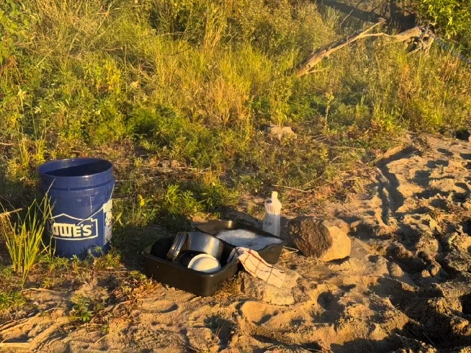
I did the dishes and settled in to wait for sunset. I had been looking forward to this west-facing beach so I could watch the sun go down. It was a beautiful event.
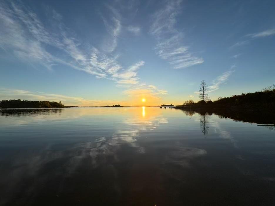
Once the sun dropped below the horizon, the mosquitoes started to swarm overhead. None of them bit me, but the sound was ominous enough. I went to bed early, hoping for a silent night’s rest. The next day I would finally go all the way to Kenora.
Day Three
How rude! A couple of guys decided to fish around my little island bright and early. I heard them chattering, and they commented that somebody was camping back there. They were kind enough to divert around my beach, but they woke me up all the same. I guess I should explain that “bright and early” means 9 AM in this case!
Needless to say, I got a good night’s sleep. I remember waking up at one point, looking outside, and seeing an amazing array of stars. There were a couple of spots on the horizon where I could see light pollution, but aside from that, it was pitch-black. The moon was down. It felt as though you could easily navigate by starlight alone. I remember that sensation from when I was much younger. It was great to feel it again.
I wasn’t really hungry for breakfast, which I chalked up to the very hearty dinner the night before. So I packed up and set my sights on Kenora. I still had the two frozen fish I brought from the cabin, so I didn’t need to catch any walleyes for dinner. I just enjoyed the ride.
By Boat into Kenora
I followed the main route past Bishop Point, up through Big Narrows, and onward. I saw one barge hauling what looked like propane tanks and maybe a fuel truck. I had expected to see more commercial traffic like that as I approached Kenora.
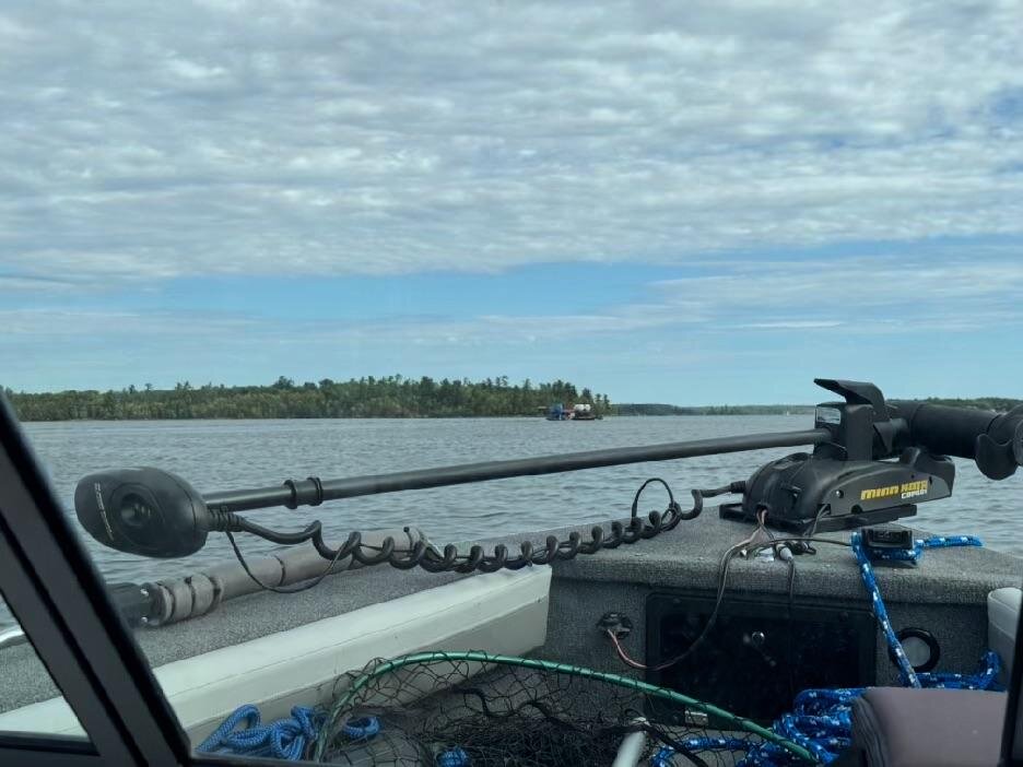
It was a pretty fun route. There were some stretches of open water and plenty of zigzags around islands. The markers were well laid out, and there were plenty of them. Many reefs were marked with floating lighted buoys, which would have been fun to see at night, but I was there during the day. I wove my way through the islands and into Kenora Harbor. One of the first things I saw was a pretty nice-looking Clarion Hotel. Tempting as it was to check availability, I decided to consider it a scouting find for a future trip.
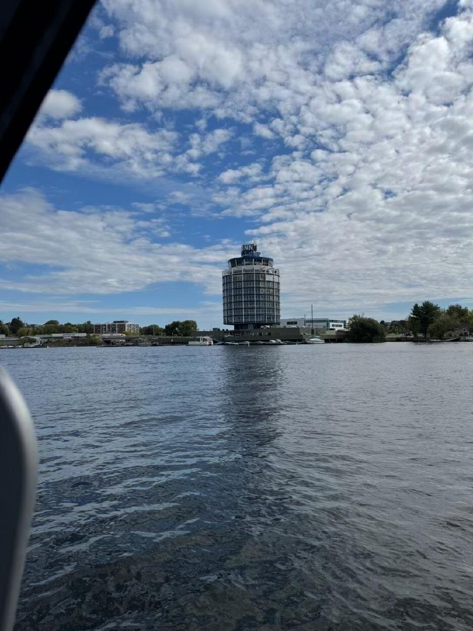
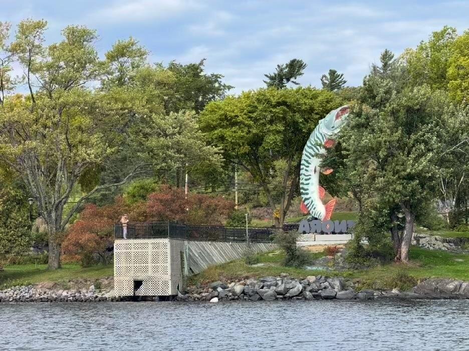
Kenora has an unusual name story. The community was originally known as Rat Portage, an English rendering of an Anishinaabe name generally translated as “carrying place to the country of the muskrats.” In 1905, the town adopted a new name made from the first two letters of three neighboring communities: Keewatin, Norman, and Rat Portage. KE-NO-RA. The giant fish I saw near the harbor was Husky the Muskie, a 40-foot-tall statue built in 1967 as a Canadian Centennial project.
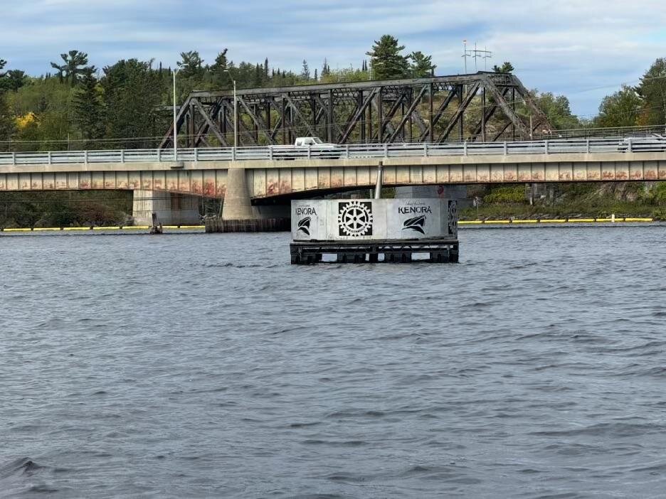
The main harbor was pretty neat, and there were a lot of people around. Some sort of event was happening at the waterside pavilion. Lots of people were fishing from the public dock. I got a closer look at Husky the Muskie and some of the dam markers.

Just west of the main harbor, I stopped at a marina fuel dock and topped up the tank: 79 L at $2.60 CAD per liter. The marina operator/bartender/shopkeeper was very curious about my trip. I suppose the boat gave me the look of a vagabond. Hopefully more vagabond than vagrant!
I was very happy to find Coke Zeros in their shop, since I was concerned that I might run out. Twelve Coke Zeros, 79 L of fuel, and a fun little chat. I passed on the walleye bisque with bannock, though it sounded good. I still had so much ham in the cooler and three-quarters of a loaf of bread.
I scouted around a bit more and decided to pull into the Discovery Center. After a nice phone call home to catch up, I tied up at the dock and decided to see what sort of discoveries I could make.
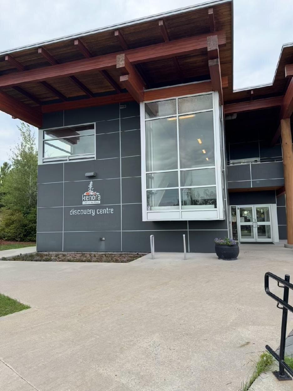
It was a neat little welcome center for Kenora. They had stuffed fish on the wall showing all the common varieties in Lake of the Woods, along with lots of tourist pamphlets and booklets upstairs. They also had an exhibit of old outboard motors, which I decided to save for next time. The person there was very friendly, and our conversation lasted longer than I had expected.
I’d had enough civilization, and it was time to get out of there. It was great to visit a small city right on the lake. They even have their own little Coney Island beach. Docks lined the shore, with businesses everywhere. Five out of five. Would recommend.
My goal was to head south, back toward the Aulneau Peninsula and away from all the main routes. There was so much to explore and so little time. I aimed for Bath Island, noting a couple of good-looking islands just to the north of it. I took my time and followed the route toward Whitefish Bay until I got past Allie Island. Then I headed due south.
I motored around a couple of islands and tested a few anchorages, but I wasn’t satisfied. At one of them, I could see through the island’s narrows to another little island on the south side that had a pretty nice-looking shape. I gradually made my way around and, much to my surprise, found a great little spot with a picnic table and a stone fire ring.
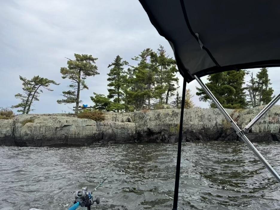
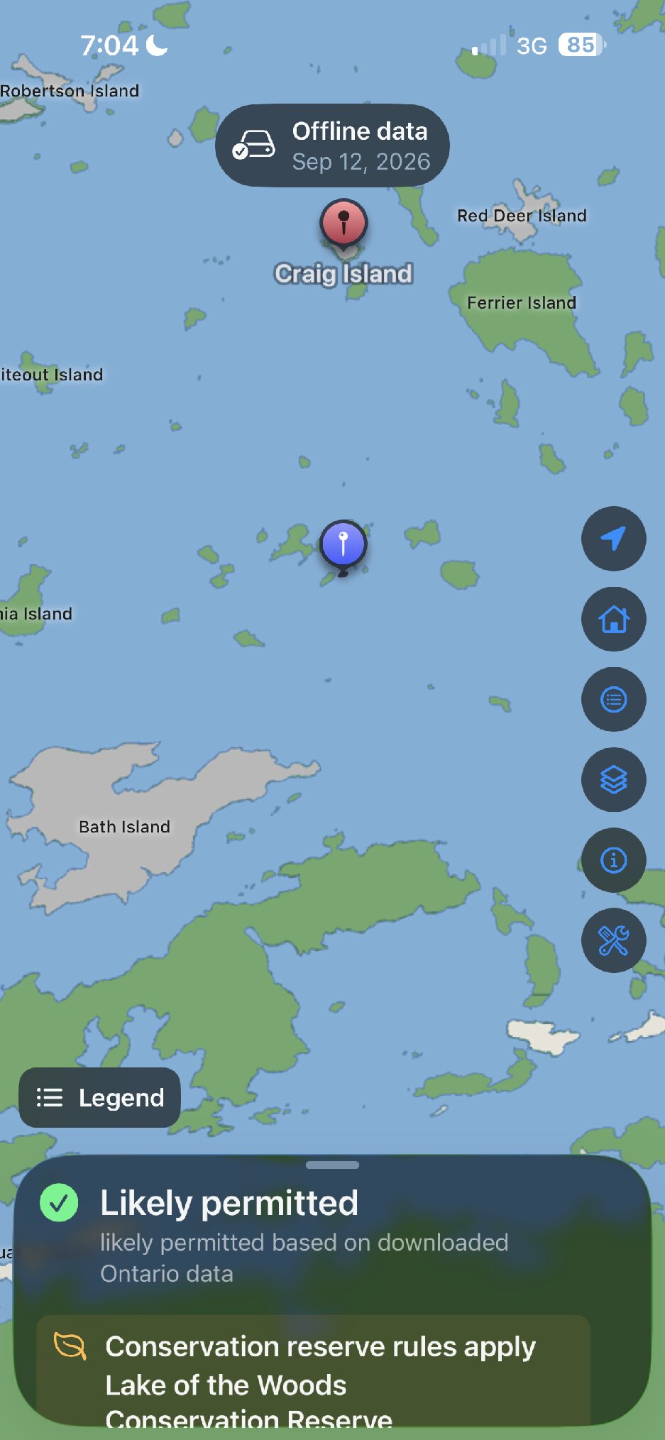
I set up camp and then went back out to troll for muskies before dinner. I had no luck, but it was fun to check out the area. There was some really deep water there, 40, 50, even 60 feet, with some nice, sharp transitions into the shallows. It was a really beautiful area of the lake.
Dinner consisted of walleye and cheese sandwiches, Cuban beans and rice, and a can of sweet corn. It was delicious, even though I burned the bottom layer of the beans and rice a bit. I guess I should’ve stirred it more often.

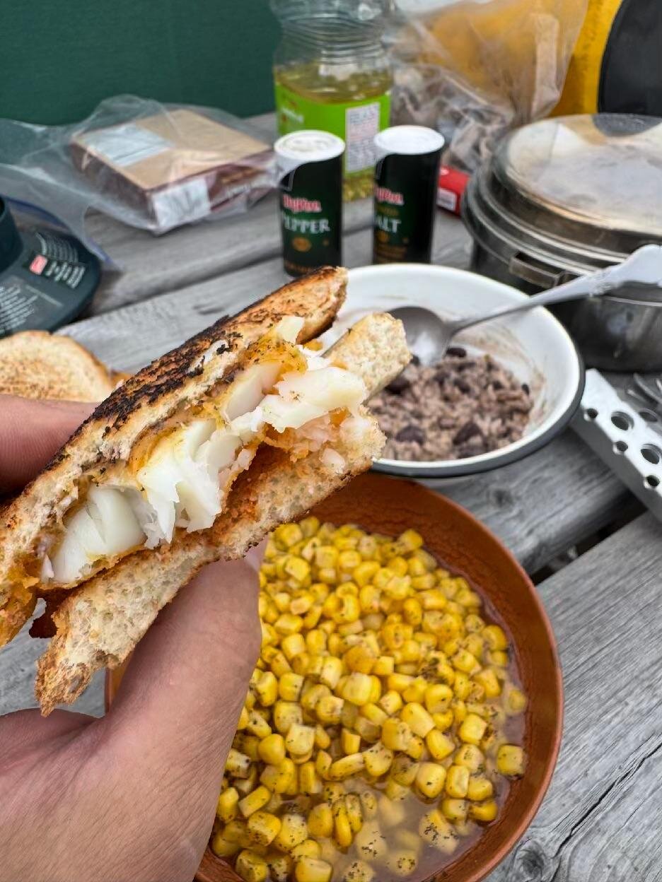
My routine was pretty well established by now. I started dinner around 5 PM, ate around 6 PM, and cleaned up by 6:30 PM. Then I got ready for the campfire and sunset, which happened around 7:30 PM. I was in the tent by 8 PM and asleep around 9 or 9:30 PM.
My 20-year-old self just threw up a bit reading that last paragraph. I used to eschew all technology, even watches, when I went camping. Somebody would ask me what time it was, and I would say, “It’s afternoon,” or, “It’s almost sunset.” Fortunately, I am wise enough now, at 51 years old, to know that just because I know what time it is doesn’t mean I have to care what time it is. I wasn’t operating by the clock. It just happened to work out that way because I was operating by the sun.
Day Four
One word for the day: rain.
Not a heavy rain, but the light, misting, persistent kind. The kind of rain that comes with fog. The kind that covers the windshield and makes it difficult to see while driving the boat. The kind that makes everything a bit damp, but not entirely soaked.
I broke camp, having already decided that I’d head home that day. My plan was to head south through Whitefish Bay, all the way down to some of the areas I used to frequent at the extreme north end of the Sabaskong Bay map.
Deep Water in Whitefish Bay
The rain was persistent, but it didn’t dampen my enthusiasm for checking out some neat features along the way. The upper part of the lake, and Whitefish Bay in particular, has some really unique underwater characteristics. It has deep holes where fish like to hang out. They were stacked up, in fact.
Whitefish Bay is much deeper and clearer than most of Lake of the Woods. Its deep, cold, oxygen-rich water provides the kind of habitat lake trout require, which made my guess about the fish on the graph seem at least plausible.
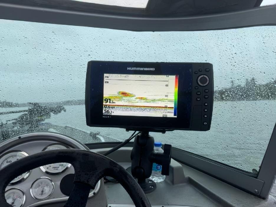
There were so many, and they were so big, that I figured they must not be walleye. I didn’t catch any, but I think they were probably lake trout. At least that’s my best guess. I tried the standard Julius family walleye approach with a bottom bouncer followed by a two-foot leader with a spinner and a Mister Twister. The images on the graph were enticing, but nothing seemed to want to bite.
At one of the stops, I noticed an even deeper hole on the other side of the islands near Three Sisters. My chart showed a depth of 217 feet. An Environment Canada bathymetry study, using Canadian Hydrographic Service charts, records the maximum depth of Lake of the Woods as 216 feet in central Whitefish Bay. The one-foot difference could be a matter of rounding, chart datum, or changing water levels, but either way, I was essentially sitting over the deepest water in Lake of the Woods.
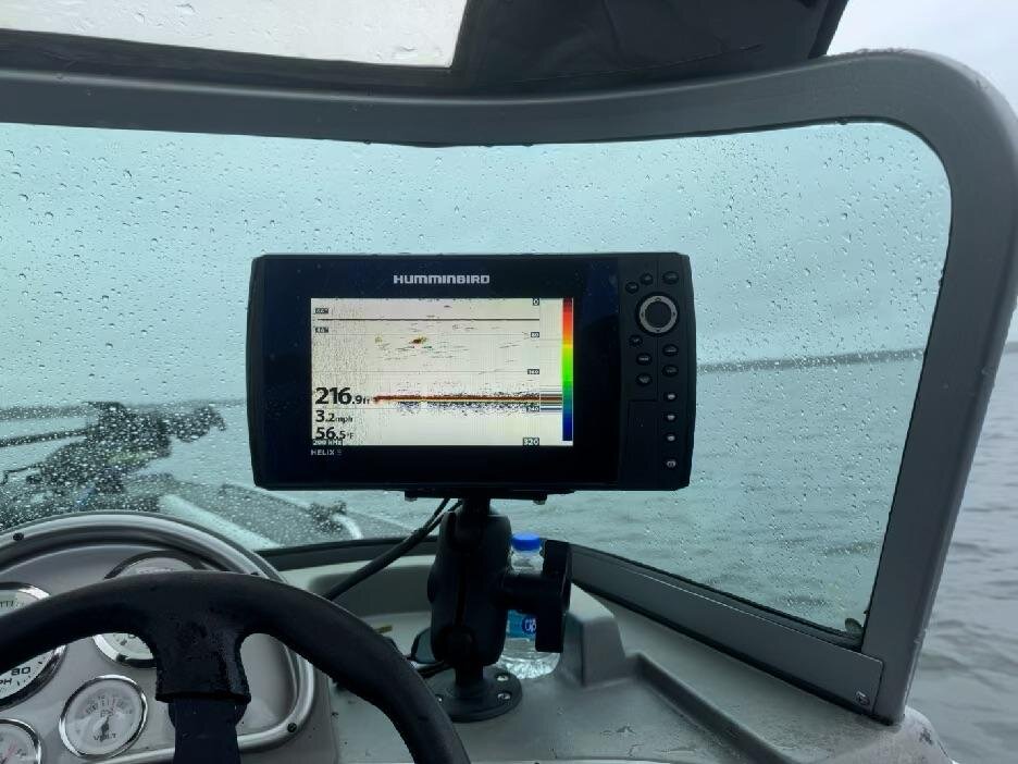
That’s one of those places I had always wanted to see, like the northernmost point of the contiguous United States, nearby at the Northwest Angle, or the southernmost point of the United States, not nearby on the Big Island in Hawaii.
The Northwest Angle owes its existence to faulty eighteenth-century geography. The 1783 Treaty of Paris relied on a map that showed the lake as roughly oval and placed the Mississippi far north of where it actually is. When surveys proved that border impossible, an 1818 agreement ran a line from the lake’s northwesternmost point south to the 49th parallel, leaving the Angle protruding into Canada.
There’s something satisfying about reaching the farthest, deepest, highest, or otherwise most extreme point of something.
Crossing Turtle Portage
I followed the route all the way down to the extreme southern end of Whitefish Bay and came to Turtle Portage.
The Aulneau Peninsula is the largest landmass on Lake of the Woods, big enough to have its own lakes, rivers, and ponds. Turtle Portage crosses the narrow strip of land that makes it a peninsula, providing a shortcut between Whitefish Bay and Sabaskong Bay. Without it, a boater would have to travel roughly 145 kilometers around the Aulneau.
Over the years, the crossing has taken several forms, including a dredged channel, a lock system, a rollerway, and finally a marine railway. The changes weren’t made merely for convenience. The open channel allowed algae-rich water from Sabaskong Bay to flow into the deep, clear water of Whitefish Bay, threatening its lake-trout habitat. The channel was eventually filled in, leaving boats to travel over the land while the two bodies of water remained separate.
I remember it being much easier when I was 20 to crank a boat over the portage. The portage trolley was on the wrong side when I arrived. I had to crank it over to my side before I even got started. The new system they have set up is really good, and it protects the boats going over the top. It’s a railway tram with a cart and a set of bunks as you’d find on a boat trailer. Pulling the boat onto the bunks, tilting up the motor, and tying off to the tram went smoothly. Cranking it over the top, though, was no small feat. I stopped every few minutes to catch my breath and recover some energy. I didn’t time it, but it certainly seemed to take all of 30 minutes.

Dropping back down into Turtle Lake on the Sabaskong Bay side felt very welcoming in a way. I didn’t really need to look at the map anymore to get home. I knew the way. I knew where the rocks were. I knew where the markers were. I even knew where people would likely be fishing at the entrance to Turtle Lake. And that ended my great camping adventure.
I came away from the trip with a newfound awe for the sheer size of Lake of the Woods. When every island and inlet is counted, the lake has more than 14,500 islands and about 65,000 miles of shoreline. Numbers like that are almost too large to mean anything until you spend four days traveling across it and realize how little you have actually seen.
I barely scratched the surface. I could probably spend a lifetime and never see it all. Every place I went, every corner, every island, every stretch of water, every narrow channel, every rock pile, and every flock of birds made me appreciate just how magical it is.
I also couldn’t wait to get home to the cabin and take a nice warm shower.
Notes and Sources
- Clothesline mooring: Clothesline Mooring, Boating Safety
- Massacre Island and Father Aulneau: Jean-Pierre Aulneau in the Dictionary of Canadian Biography
- How Kenora got its name: The why of the town’s name change, The Muse Kenora
- Husky the Muskie and the old Rat Portage townsite: Rat Portage Trail walking tour (PDF), City of Kenora
- The Aulneau Peninsula and Turtle Portage: The history of Turtle Portage, Northern Ontario Travel
- The Northwest Angle: Northwest Angle, MNopedia
- Whitefish Bay and lake-trout habitat: Canary in the lake, Lake of the Woods District Property Owners Association
- Lake of the Woods depths: Lake of the Woods bathymetry report (PDF)